Wandrer Introduces Garmin Integration, iOS App, and New Routing Tools
Wandrer Launches Major Features Driven by Community Input
17 November 2026 – Wandrer has rolled out a series of updates to its platform, introducing new mobile, hardware, and navigation features for its global user base. The update focuses on expanded device compatibility, new exploration metrics, improved route-planning tools, and enhanced advanced mapping features. These updates introduce long-requested tools designed to help walkers, runners, and cyclists track their progress and explore new ground.
This rollout is a direct result of user feedback and community discussion. Every new feature—from new geographic tracking metrics to specific navigation adjustments—was built to answer the exact needs and requests of the Wandrer community.
Among the headline updates are the launch of the official Wandrer application for iOS devices and a dedicated app for Garmin Edge bike devices. The platform has also expanded its navigation toolkit with point-to-point A→B routing and a specialized "Every Road in an Area" tool, which creates optimized routes covering all available streets within a designated zone.
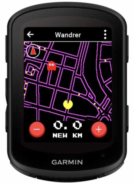
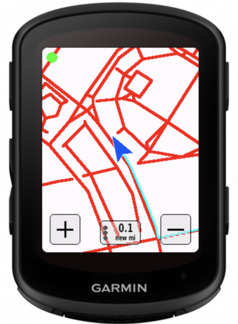
A major technical milestone in this release is the new Wandrer Garmin App and Data Field. Built specifically for Garmin Edge cycling computers, this integration completely replaces the old, multi-step process of manually generating, downloading, and transferring massive map files onto a Garmin device via a computer. Instead, the data field pulls a user’s personal Wandrer map data live from the cloud, calculating new road coverage in real-time during an activity. It also introduces a gamified "Arcade Mode," offering an entirely new, highly interactive approach to collecting untravelled roads on the go.
The Wandrer iOS app (soon available for Android) lets you record your bike and foot activities and shows you your new road progress in real-time (both on the map and total number) as well as your progress in the areas you’re traveling through. It will also soon let you use Wandrer’s routing features to travel to a location while maximizing your new roads along the way.
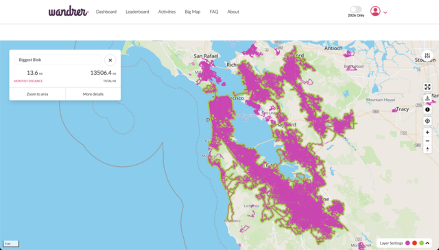
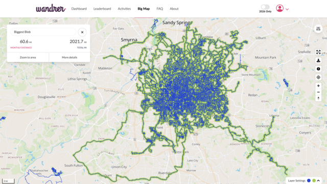
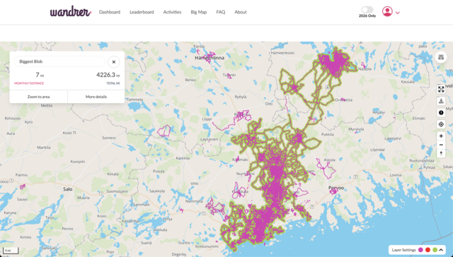
To give users more ways to track their geographic milestones, Wandrer has introduced the "Biggest Blob" metric. Acting as Wandrer’s unique take on classic "tile hunting," this feature shifts the focus away from completely filling out a traditional neighborhood boundary or city map. Instead, it challenges athletes to build their largest continuous network of interconnected roads. To prevent minor mapping anomalies or inaccessible segments from breaking a user's progress, the algorithm features a built-in tolerance that allows for gaps of up to 100 meters. The feature is already driving viral engagement on platforms like Reddit, proving to be a surprising gamified motivator for users to venture into unfamiliar territory in order to link disconnected paths.
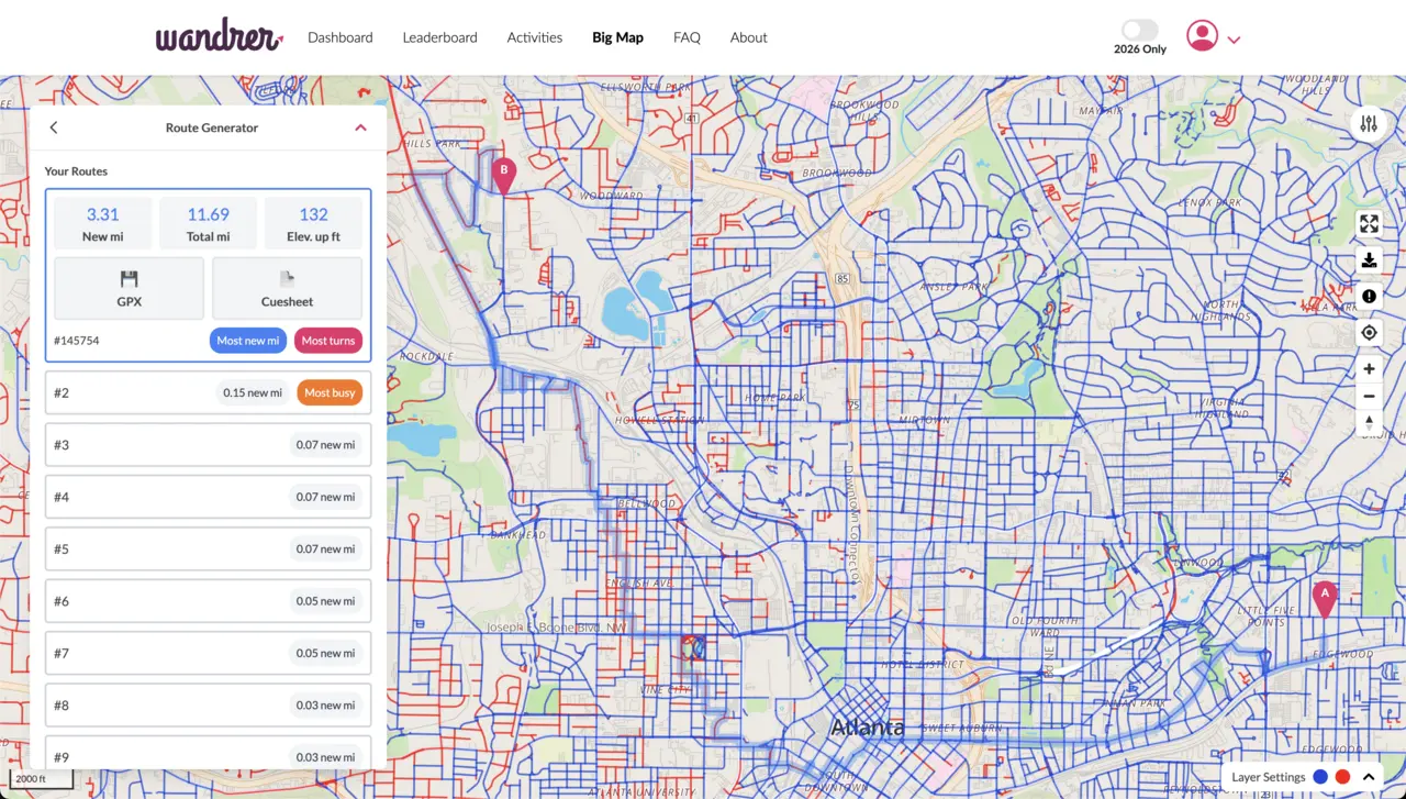
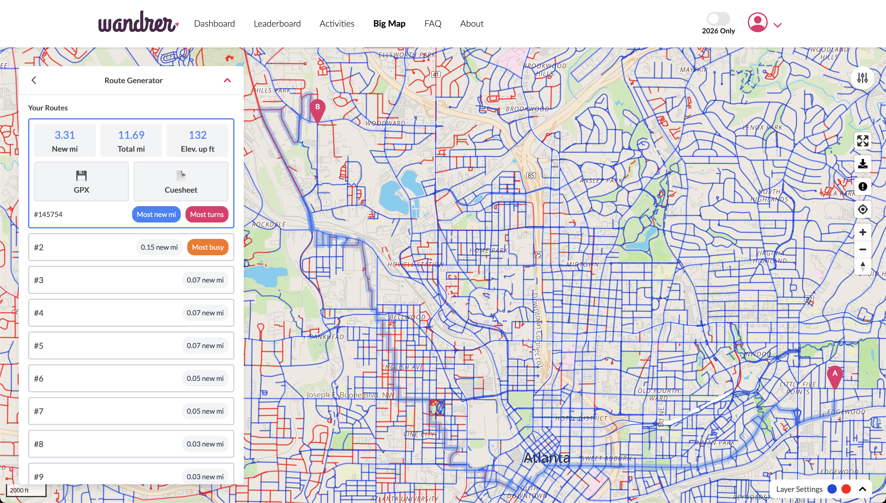
Wandrer also debuted its routing features this year, including point-to-point routing. This unique tool allows you to route from point A to point B while maximizing your untraveled roads along the way. Simply specify how much extra distance you’re willing to travel and it will provide several options for you.
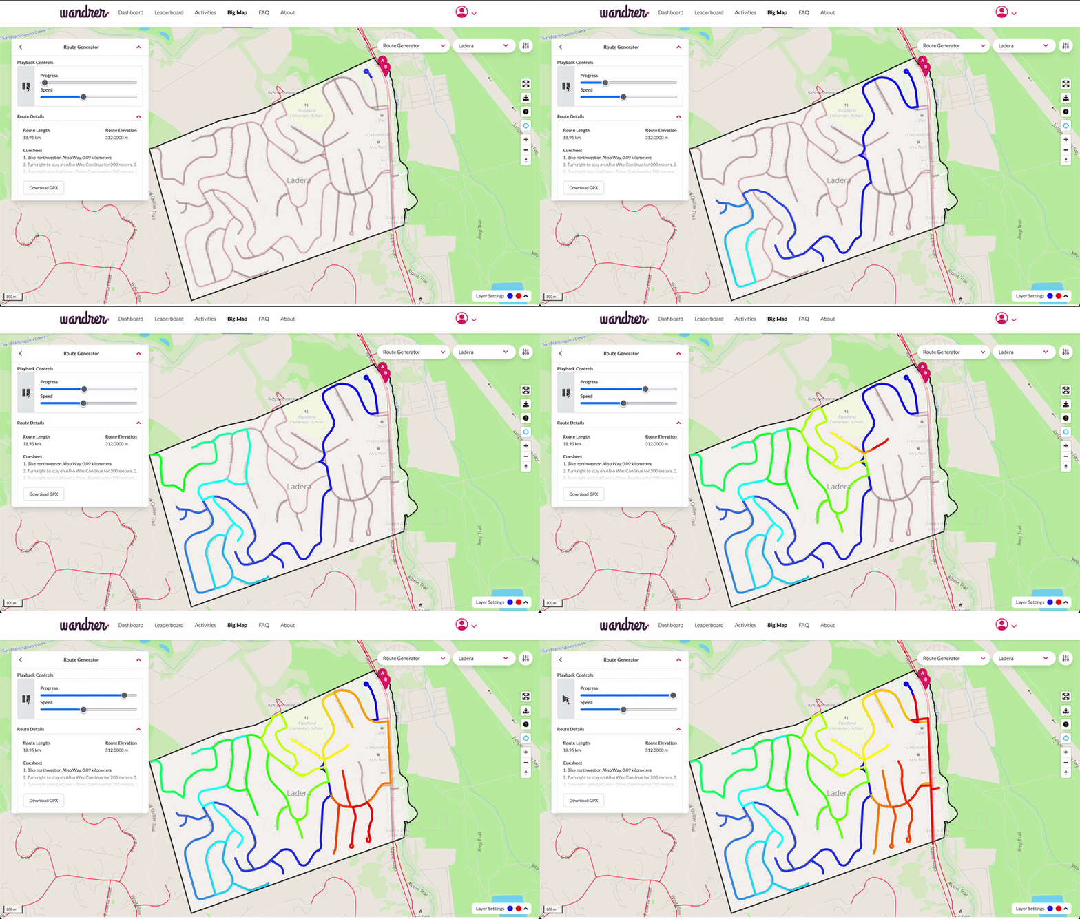
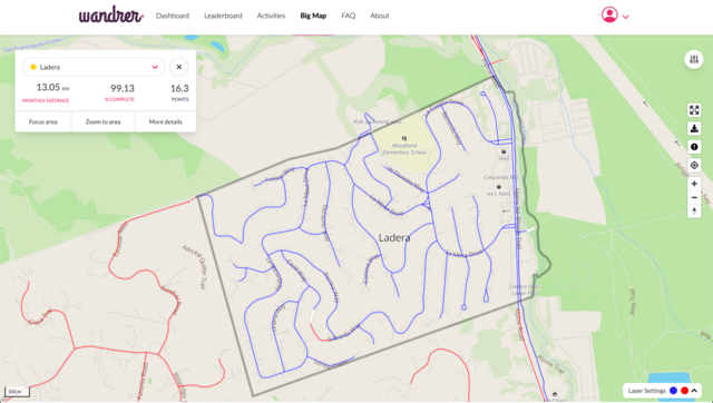
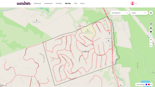
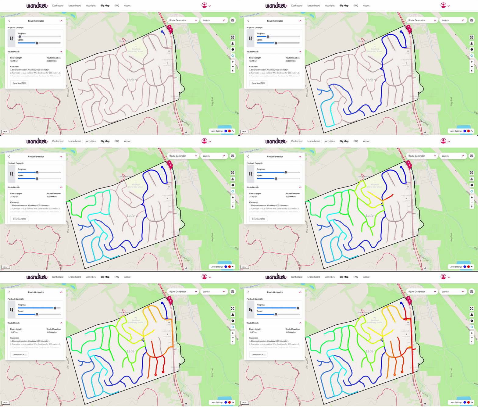
Wandrer also introduced “100%” routing, a tool to let you draw a shape on the map, set a start and end point, and generate a route that covers every road in the shape (with options to exclude dead-ends and unpaved roads if you’re not feeling that picky). Useful for when you want to knock out an entire neighborhood at once!
Additionally, the platform added support for tunnels, Catalan localization, a year-only mode that only considers activities in 2026, and activity search by name. The update also integrates EuroVelo bike trails and an expanded selection of long-distance routes.
"Our community is the ultimate engine behind everything we build, and these features are a direct reflection of their real-world tracking needs," said Craig Durkin, founder of Wandrer. "Whether it’s bringing the map directly to a Garmin Edge device on the handlebars or launching the new iOS app, these updates exist because our users asked for them. We're especially excited about the 'Biggest Blob' feature. Wandrer has always been about encouraging people to ride and run in new places. While we've historically focused on helping folks check off entire towns or cities, this new metric rewards connection. It has been incredible to see users heading out to connect random, orphaned bits of their map—biking just a few miles to bridge a gap and watching their main continuous blob instantly grow by 20 miles. We are incredibly grateful to our community for pushing the platform forward."
Summary of New Features and Platform Updates
- Wandrer iOS App: Launch of the official Wandrer application for iOS devices.
- Wandrer Garmin App & Data Field: Direct integration for Garmin Edge bike devices that streams map data live from the cloud and calculates new coverage in real-time. Replaces manual generation, downloading, and transferring of map files, and introduces a gamified "Arcade Mode" for collecting roads.
- Routing Tools:
- A→B Routing: Tools for planning point-to-point routes.
- "Every Road in an Area": A specialized tool designed to map optimized routes that cover all available streets within a selected zone.
- Exploration Metrics:
- "Biggest Blob": A gamified metric tracking a user's largest continuous network of interconnected roads, utilizing a 100-meter gap tolerance to skip minor mapping hurdles and encourage exploration beyond traditional neighborhood boundaries.
- Single Entry/Exit Tunnel Credit: Support for receiving map credit when navigating tunnels with one entry and exit point.
- Expanded Trail Mapping: Addition of EuroVelo bike trails and extra long-distance routes.
- Platform Functionality:
- Activity Search by Name: Ability to search past activities by title.
- Year-Only Mode: A setting to isolate and view data from a specific year.
- Catalan Localization: Full language support for Catalan.